1
/
of
1
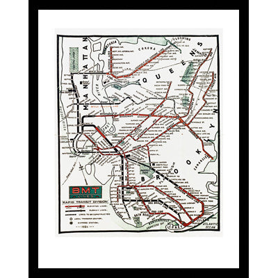
BMT Lines Rapid Transit Division, 1925 Print
Item # 18176-20
- Regular price
-
$37.00 - Regular price
-
- Sale price
-
$37.00
Couldn't load pickup availability
BMT Subway and Elevated Line Map, "BMT Lines Rapid Transit Division" 1925.
Reproduced from the collection of the New York Transit Museum
The Brooklyn-Manhattan Transit Corporation adopted a clear, simplified, geographically-based map style. The map shows routes as thick, exaggerated lines - with elevated sections (in red) distinguished from subways (black) - and highlights the East River bridges and subway tunnels.
Pictured to the left framed.
Available in the following sizes:
16x20" for $33 unframed
16x20" for $104.50 framed
22x28" for $66 unframed
22x28" for $165 framed
Size in inches Height x Width
Paper: 16 x 20 Image: 10 15/16 x 15
Paper: 22 x 28 Image: 16 x 22
Classic black frame measures 1 1/16" wide.


BMT Lines Rapid Transit Division, 1925 Print
- Regular price
-
$37.00 - Regular price
-
- Sale price
-
$37.00


